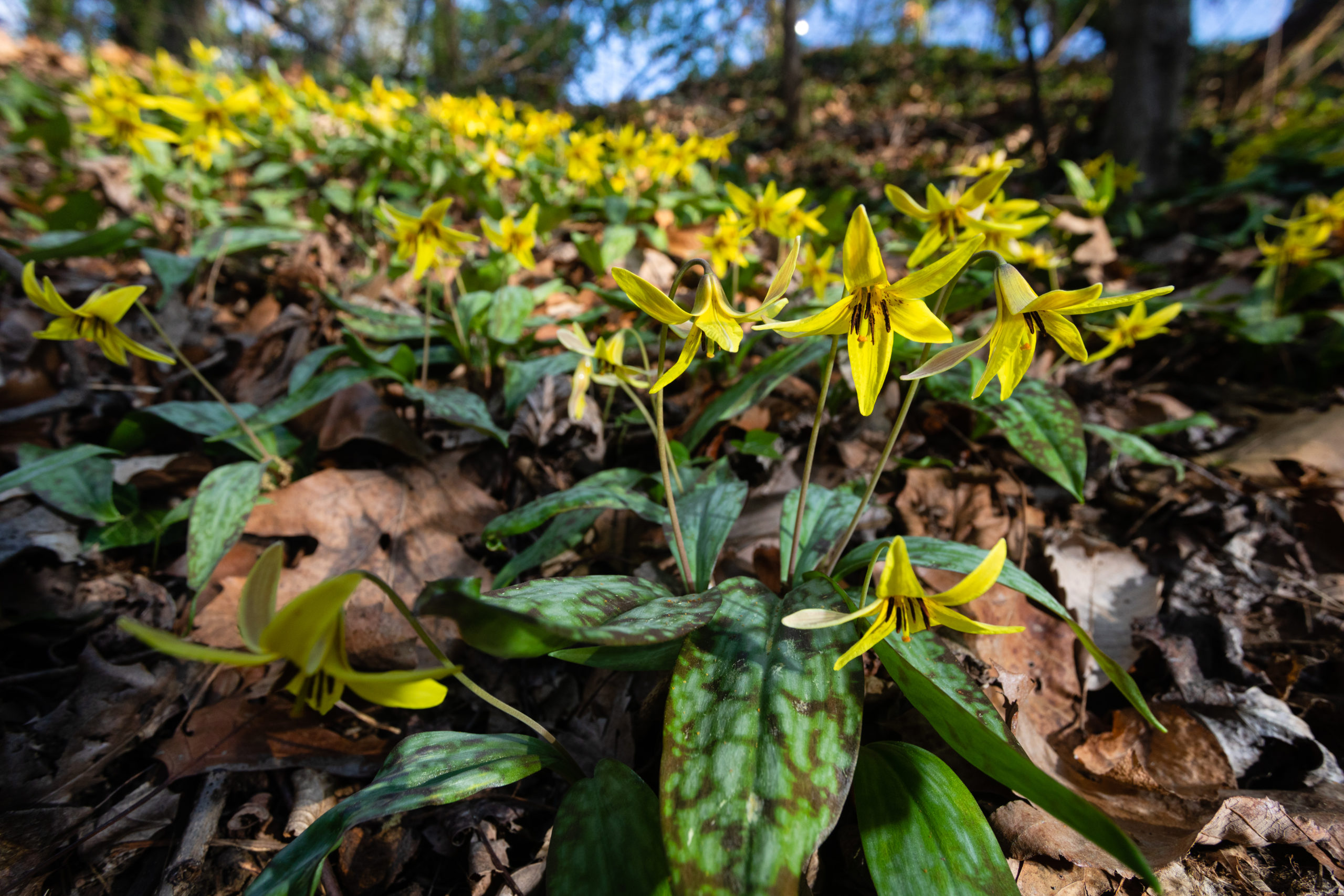
The name “trout lily” comes from the plant’s mottled leaves, which look like the markings on brook trout. Above, yellow trout lilies bloom at Truxtun Park in Annapolis, Md., on Monday, April 6, 2020.(Photo by Will Parson/Chesapeake Bay Program)
The Appalachian Trail (AT) covers approximately 2,190 miles along the East Coast, bringing hikers as high as 6,600 feet in elevation. This landscape provides an excellent area for understanding how plant phenology—the timing of their life-cycle events like flowering and fruiting—is related to climate and how changes across the AT’s climate gradients could impact ecosystem resilience and biodiversity.
With iNaturalist, you can help scientists better track shifts and changes along the AT, whether you are out for a day hike or longer. The data collected will inform AMC scientists on the life stages and impacts climate has on these plants, while information about birds, snakes, bugs, and mammals you spot on the trail will help paint a broader picture of the region. All living organisms reported along the AT corridor remind us of the value of this connected mountain landscape as a home and throughway for nature’s wildlife.
Join AMC and report your observations from your next AT hike!
About iNaturalist
iNaturalist is a tool that crowdsources plant and animal observations through a free app on your phone or tablet. Our project uses it to focus on the flowering season of woodland plants along the AT corridor. All you need is a mobile device with a camera—it even works when you don’t have reception.
To get started:
(1) Download the iNaturalist app and register. If you don’t have a chance to do this before you hit the trail, you can always do it once you are back and reviewing all the flower photos from your hike!
(2) Turn on location in your mobile device if you have turned it off previously. This ensures that your photos are dated and geo-tagged so that when you use the iNaturalist app the photo brings that data along.
(3) Take photos of flowers, especially our target species. Take a photo of the whole plant if possible and a close-up of flowers or fruit. You should take photos while in the iNaturalist app, but any photo you have captured with your phone’s camera can be uploaded later, even previous years’ photos. Using the app will ensure that more accurate location data is logged.
(4) Join AMC’s iNaturalist projects. By joining the “AT Corridor” team you can streamline your contribution to AMC’s research and get updates on the project through iNaturalist journal posts. Be sure to select ‘allow researchers to see coordinates’ when you join so that we can use the data you’ve collected. Observations not posted to our project are still accessible for research, so snap away!
Don’t forget to check back in on your iNaturalist submissions so you can learn more as you go. iNaturalist has built-in identification technology and plenty of fellow naturalists who can help confirm a species and move your observation to “Research Grade.” This allows AMC’s scientists and other researchers to use it in our work.
The more photos we take, year after year, the more we can learn about flowering and fruiting times and the impact of climate change.
LEARN MORE
Help AMC Scientists Study Climate Change’s Effect on Alpine Plants – Appalachian Mountain Club
8 Wildflower Hikes to Brighten Your Spring and Summer – Appalachian Mountain Club
AMC iNaturalist Project Brings Citizen Science to the Appalachian Trail – Appalachian Mountain Club